Major Taylor Trail Chicago: Route, Length, Access and History
The Major Taylor Trail is a paved South Side rail-trail from Dan Ryan Woods to Whistler Woods, about 8.1 miles. Sections, access, hours, the racer it honors.
The Major Taylor Trail is a paved rail-trail on Chicago's far South Side and in Riverdale, running from Dan Ryan Woods south to Whistler Woods1. The Forest Preserves estimate its length at 8.1 miles1. Most of it is off-street, but the stretch from 95th to 105th Street runs on neighborhood bike lanes2.
- At a glance
- Length
- 8.1 miles, estimated total1
- Ends
- 81st St (Dan Ryan Woods) to 134th St (Whistler Woods)2
- Opened
- 2007, on an abandoned railroad line3
On this page
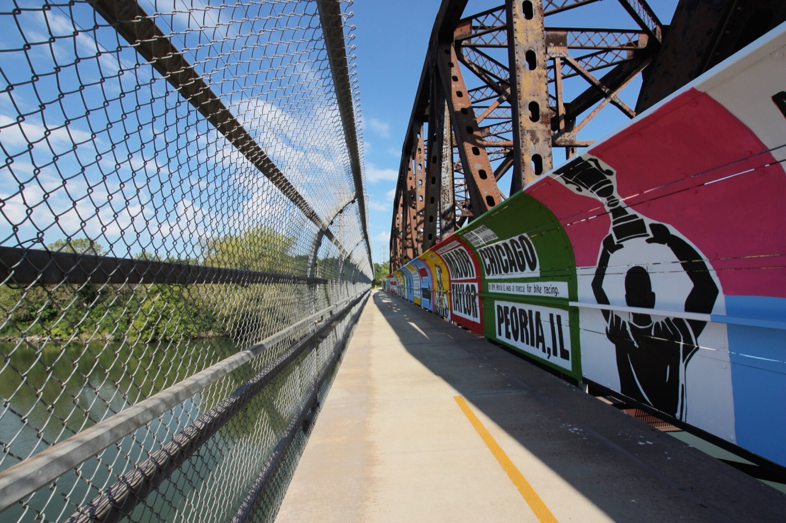
The Major Taylor Trail is the South Side’s rail-trail, a path through Beverly, Morgan Park and West Pullman that ends in the village of Riverdale. It is named for Marshall “Major” Taylor, one of the most celebrated racers of the late nineteenth century. Start from the Routes & Trails hub for the rest of the network.
The route, section by section
The Chicago Park District, which manages much of the trail, splits it into four sections2:
| Section | Ground |
|---|---|
| 81st to 95th Street | Off-street trail through Dan Ryan Woods Forest Preserve2 |
| 95th to 105th Street | On-street bike lanes through neighborhood streets2 |
| 105th Street to 129th Place and the Little Calumet River | Off-street trail through park space2 |
| 129th Place to 134th Street | Off-street trail through Whistler Woods Forest Preserve2 |
The trail runs through Brainerd, Gresham, Beverly, Morgan Park, Roseland and West Pullman, as well as the village of Riverdale2. It touches five wards and crosses three Metra lines4.
How long it is
The Forest Preserves estimate the total length at 8.1 miles1. The Park District places the ends at 81st Street on the north and 134th Street on the south2.
Where to get on
The Forest Preserves list these access points, north to south1:
| Access point | Location |
|---|---|
| Dan Ryan Woods-North | W 83rd Street, east of S Western Avenue, Chicago1 |
| Dan Ryan Woods-91st Street | W 91st Street and S Hermitage Avenue, Chicago1 |
| Whistler Woods | Forest View Avenue, east of S Halsted Street, Riverdale1 |
Forest Preserve land is open year-round from sunrise to sunset1. Dogs must be on a leash1. The Park District lists park hours of 6 am to 11 pm for its portion2.
History of the trail
The trail was built on an abandoned railroad line. The City calls it one of Chicago’s first rails-to-trails projects and gives 2007 as the year it opened3. In 2006 the Park District signed a lease with the Chicago Department of Transportation to manage and maintain the site2.
Who Major Taylor was
Marshall W. Major Taylor lived from 1878 to 1932 and was one of the most celebrated bicycle racers of the late nineteenth century2. He was born in Indianapolis in 18781. He performed bicycle tricks while wearing a soldier’s uniform, which gave him the nickname “Major”1. The Forest Preserves say he was one of the first African-American athletes to become a world champion in any sport, and for many years was known as the fastest bicycle rider in the world1.
What is planned
Several plans are in motion. The Forest Preserves said they were completing a corridor master plan for the trail along Dan Ryan Woods1. Since 2022 the City’s Department of Planning and Development has worked on two plans3. One is a land use framework for the trail between 104th and 125th Streets, through Beverly, Morgan Park and West Pullman3. The other is a consolidation plan, the first document in the trail’s 20-year history to take a holistic view of its future goals and improvements3.
In 2023 the Active Transportation Alliance reported that the plan recommends installing branded sign markers and locator maps to help trail navigation4.
For a neighboring route, see the Burnham Greenway or the Cal-Sag Trail.
Read next
Burnham Greenway: Route, Access Points and the Gap Plan
The Burnham Greenway is a paved former railroad trail of about 11.5 miles from Eggers Grove in Chicago to Lansing. Access, on-street stretches, planned bridge.
routesCal-Sag Trail: Route, Length, Access Points and Open Gaps
The Cal-Sag Trail follows the Cal-Sag Channel from Lemont toward the Burnham Greenway, 26.8 miles when finished. Access points, the 2025 extension, open gaps.
routesHyde Park and Jackson Park Bike Ride: Route, Sights and Where to Stop
Ride the Lakefront Trail south to Jackson Park and Hyde Park: the Museum of Science and Industry, the Japanese garden, Promontory Point and the Obama Center.
Questions people ask
How long is the Major Taylor Trail?
The Forest Preserves of Cook County list an estimated total length of 8.1 miles1.
Where does the Major Taylor Trail start and end?
It runs from Dan Ryan Woods in Chicago south to Whistler Woods in Riverdale1,3. The Park District puts the ends at 81st Street on the north and 134th Street on the south2.
Is the Major Taylor Trail paved?
Yes. The Forest Preserves list the surface as paved1. Part of the route is on-street bike lanes managed by the Chicago Department of Transportation2.
Sources
- Major Taylor TrailGOV
Forest Preserves of Cook County (via Wayback) · fpdcc.com · checked 2026-10-19 - Major Taylor Bike TrailGOV
Chicago Park District (via Wayback) · chicagoparkdistrict.com · checked 2026-10-19 - Major Taylor Trail PlanningGOV
City of Chicago, Department of Planning and Development (via Wayback) · chicago.gov · checked 2026-10-19 - South Side trail updates and improvementsNONPROFIT
Active Transportation Alliance · activetrans.org · checked 2026-10-19
Photo credits (1)
- Bkc2010 / Wikimedia Commons · CC BY-SA 4.0 · source

Laws are quoted from Illinois statute and the Chicago Municipal Code; prices from each operator on the date shown. Editorial policy · Corrections.