Cal-Sag Trail: Route, Length, Access Points and Open Gaps
The Cal-Sag Trail follows the Cal-Sag Channel from Lemont toward the Burnham Greenway, 26.8 miles when finished. Access points, the 2025 extension, open gaps.
The Cal-Sag Trail is a paved trail along the Cal-Sag Channel and Calumet River, planned to run 26.8 miles from Lemont to the Burnham Greenway near the Indiana border1,2. The first 13 miles opened in June 20152. The eastern portion is not complete, so ride the west and check the map for the rest1.
- At a glance
- Length
- 26.8 miles, estimated total for the finished trail1
- Surface
- Paved1
- West end
- Sag Quarries, Archer Ave near Lemont1
- Hours
- Year-round, sunrise to sunset1
- Open gaps
- Alsip (Cicero Ave to Blue Island) and Dolton, as of 20233
On this page
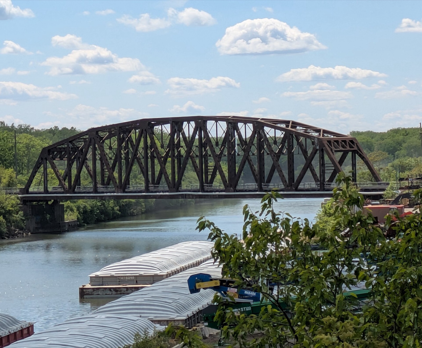
The Cal-Sag Trail is built almost entirely along the banks of the Cal-Sag Channel and the Calumet River3. Most of it is open, and the first 13 miles opened in June 20152,3. See Routes & Trails for the full network.
Route and length
The trail stretches from Lemont in the west to Burnham in the east, near the Indiana border3. The Forest Preserves place it in Alsip, Blue Island, Calumet City, Dolton, Lemont, Palos Heights and Riverdale, and list a paved surface1. It is open year-round from sunrise to sunset, with dogs on leash only1.
The Forest Preserves estimate the total length at 26.8 miles1. That is the finished trail, not what is open: the Metropolitan Water Reclamation District (MWRD) says the trail will eventually reach the Burnham Greenway near the Indiana border2.
The first 13 miles of the western section opened in June 2015, on land half donated by the MWRD2. The MWRD built the 16-mile channel the trail follows in 19222.
Where to get on
The Forest Preserves list access points from west to east, and the maps show on-street and bikeway connections1.
| Access point | Location |
|---|---|
| Sag Quarries | Archer Avenue and Old Archer Avenue, near Lemont1 |
| Teason’s Woods | S Willow Springs Road, south of Calumet Sag Road (Route 83)1 |
| Cal-Sag Parking, owned by the Village of Palos Park | IL-83 and S 86th Avenue, Palos Park1 |
| Lake Katherine Nature Center, owned by the City of Palos Heights | 7402 Lake Katherine Drive, Palos Heights1 |
| Freedom Park, owned by the Alsip Park District | 131st Street and Cicero Avenue, Alsip1 |
| Whistler Woods | Forest View Avenue, east of S Halsted Avenue, Riverdale1 |
Three of these access points are owned by local governments, not the Forest Preserves: Palos Park, Palos Heights and the Alsip Park District1. At Whistler Woods the Forest Preserves warn that the eastern portion of the trail is not complete and only a small portion is accessible1.
What is open and what is missing
In November 2023 the Active Transportation Alliance reported that most of the trail was up and running, with two segments incomplete3. One lies between Cicero Avenue in Alsip and Francisco Street in Blue Island3. The stretch between Freedom Park and Pulaski Road had been held up for six or seven years while the Alsip Park District and Cook County’s transportation department negotiated safe railroad crossings3. The eastern segment in Dolton was also incomplete3.
The Forest Preserves page still lists the eastern portion as incomplete, so check the web map or PDF map before you plan a ride east of Alsip1.
The 2025 Palos Hills extension
On August 19, 2025, the MWRD joined Palos Hills and Cook County officials to cut the ribbon on a 1.5-mile extension of the Cal-Sag Trail network2. It helps riders reach Moraine Valley Community College, Amos Alonzo Stagg High School and the Palos Heights Metra Station2. The Cook County Department of Transportation and Highways paid for it through its Invest in Cook Program2.
Who lives along it
About 185,000 residents in 14 nearby communities live within a mile of the trail3. When completed, the trail will connect to regional trails, bus and rail transit, retail areas, parks, forest and nature preserves, marinas and golf courses3. The MWRD leases large parcels of land to park districts, municipalities and forest preserve districts for trails and recreation along the waterways2.
The trail is also planned to join the Burnham Greenway. For a South Side route nearby, see the Major Taylor Trail.
Read next
Burnham Greenway: Route, Access Points and the Gap Plan
The Burnham Greenway is a paved former railroad trail of about 11.5 miles from Eggers Grove in Chicago to Lansing. Access, on-street stretches, planned bridge.
routesMajor Taylor Trail Chicago: Route, Length, Access and History
The Major Taylor Trail is a paved South Side rail-trail from Dan Ryan Woods to Whistler Woods, about 8.1 miles. Sections, access, hours, the racer it honors.
routesI&M Canal State Trail: Rockdale to LaSalle by Bike
The Illinois & Michigan Canal State Trail runs 61.5 miles along the old towpath from Rockdale to LaSalle. Sections, surface, stops and tires.
Questions people ask
How long is the Cal-Sag Trail?
The Forest Preserves of Cook County list an estimated total length of 26.8 miles1. That is the finished length; the eastern portion is not complete1.
Where does the Cal-Sag Trail start and end?
The west end is Sag Quarries, at Archer Avenue and Old Archer Avenue near Lemont1. The planned east end meets the Burnham Greenway near the Indiana border2. Whistler Woods in Riverdale is the last listed access, and only a small portion of the trail is accessible there1.
Is the Cal-Sag Trail finished?
No. The Forest Preserves say the eastern portion is not complete1. In November 2023 the Active Transportation Alliance reported two incomplete segments: one between Cicero Avenue in Alsip and Francisco Street in Blue Island, and one in Dolton3.
Is the Cal-Sag Trail paved?
Yes. The Forest Preserves list the surface as paved1.
Where can I get on the Cal-Sag Trail?
Access points run west to east: Sag Quarries, Teason's Woods, the Palos Park lot at IL-83 and 86th Avenue, Lake Katherine Nature Center, Freedom Park in Alsip, and Whistler Woods in Riverdale1.
Sources
- Cal-Sag TrailGOV
Forest Preserves of Cook County (via Wayback) · fpdcc.com · checked 2026-10-19 - MWRD, Cook County and Palos Hills partners unveil Cal-Sag bike and walking pathGOV
Metropolitan Water Reclamation District of Greater Chicago (via Wayback) · mwrd.org · checked 2026-10-19 - South suburban trails are about to get more connectedNONPROFIT
Active Transportation Alliance (via Wayback) · activetrans.org · checked 2026-10-19
Photo credits (1)
- Crosbiesmith / Wikimedia Commons · CC BY-SA 4.0 · source

Laws are quoted from Illinois statute and the Chicago Municipal Code; prices from each operator on the date shown. Editorial policy · Corrections.