Chicago Bike Lanes: Network Map, Lane Types and How to Ride Them
Chicago has 501 miles of bikeways, 69 of them protected. What each lane type means, where the network is growing, and how to ride it.
As of December 2025 Chicago had 501.2 miles of bikeways, including 68.7 miles of protected bike lanes, 85.2 miles of neighborhood greenways and 55.3 miles of off-street trails. CDOT prints a free bike map every spring. Protected lanes are separated from traffic by concrete barriers, plastic curbs and delineators, or shifted parking lanes.1,3
- At a glance
- Total network
- 501.2 miles, December 20251
- Protected bike lanes
- 68.7 miles1
- Neighborhood greenways
- 85.2 miles1
- Off-street trails
- 55.3 miles1
- Low-stress share
- 42% of the network2
- Bike map
- Free, printed each spring1
On this page
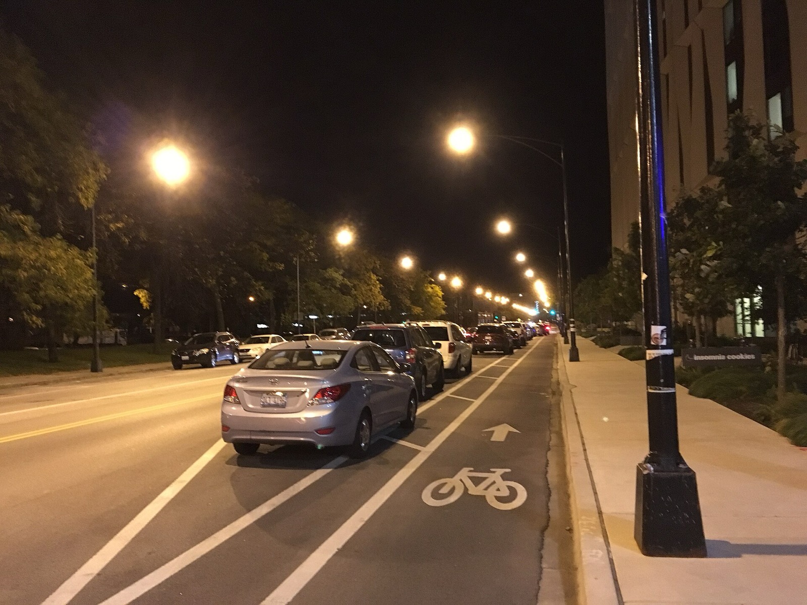
Chicago’s bikeway network is large and easy to misread. Each kind of lane works differently, and the kind you are on decides how you should ride it.
The network in numbers
Chicago’s cycling network includes over 500 miles of bikeways.2 CDOT’s table gives 501.2 miles as of December 2025 and is updated quarterly as segments are installed or upgraded.1 CDOT installed 100 miles of cycling infrastructure in the past three years, and 42% of the network is low-stress.2
Growth has not been confined to the Loop and the North Side. More than half of the expansion has been on the South and West sides.4
| Facility | Miles, December 2025 |
|---|---|
| Protected bike lanes | 68.71 |
| Neighborhood greenways | 85.21 |
| Off-street trails | 55.31 |
| Total network | 501.21 |
CDOT also tracks buffered lanes, standard lanes and marked shared lanes.
Lane types, from safest to shared
Protected bike lanes
A protected lane is dedicated space physically separated from vehicles on higher-traffic streets. The separation may be concrete barriers, plastic curbs and delineators, or parking lanes shifted away from the curb.3 CDOT says protected lanes narrow the roadway and prompt drivers to travel at safer speeds.2
The city installed over 12 miles of them in 2025. They now make up over 15% of the on-street network.2 Concrete is becoming the standard. CDOT’s 2023 cycling update says it has begun upgrading all existing protected lanes with concrete curbs, and that all new ones will have concrete protection.5
Neighborhood greenways
A greenway turns a residential street into a low-stress alternative to an arterial. The tools are traffic calming, signage and special pavement markings.3 Some greenways also allow two-way bike travel on a one-way street.3
The routes often include speed humps, a 20-mph speed limit, raised crosswalks, curb extensions and contraflow bike facilities.2 CDOT added 14 miles in 2025, bringing the total to 85 miles, nearly 20% of the network.2
On Long Avenue, a one-way conversion helped produce a 97% drop in the share of drivers going above 20 mph.2
Bike lanes, buffered lanes and shared lanes
A standard lane is on-street space marked with signs, striping and pavement markings.3 A buffered lane adds extra space for clearance from the door zone and moving traffic.3
A CDOT guide describes a bike lane as five to six feet wide, striped, and marked with a large white bicycle.6
A marked shared lane is a travel lane with pavement markings and signs. The markings stress the presence of cyclists and their right to use the full lane.3
Off-street trails
Chicago has over 50 miles of car-free trail, including the Major Taylor Trail, the 606 and the Lakefront Trail.3 Start with the 606 or the Lakefront Trail when you want no cars at all.
Intersection markings
Intersections are where lanes change character, and CDOT uses a few distinct treatments.
- Bike boxes. A green-painted space at the edge of an intersection lets cyclists wait during a red light. Drivers should stop at the stop bar before the box.3
- Bike turn boxes. Where a turn is difficult, proceed straight across on the green, then reposition the bike and go in the new direction on the next green.3
- Dashed markings. Dashes show a shared space between motorists and cyclists and push drivers to take care when turning.3
- Advisory lanes. On narrow two-way streets, drivers must check for cyclists on the right, slow, and let them pass before moving into the dashed lane.3
- Dotted lane stripe. When the stripe turns dotted, motorists may cross the lane to turn. Hold your position, and be ready to slow for a driver who does not yield.6
How to ride the lanes
You are not required to use a bike lane. A bicyclist may use the adjacent travel lane when moving at the speed of traffic.6 Illinois law sets the baseline: ride as close as practicable and safe to the right-hand curb or edge of the roadway.7
Shall ride as close as practicable and safe to the right-hand curb or edge of the roadway.7
That rule bends for hazards. It allows leaving the right edge when reasonably necessary to avoid fixed or moving objects or parked or moving vehicles.7
Position matters more than the paint. In a lane beside parked cars, ride on the left side of the lane so an opening door will not hit you.6
Maintenance and winter
CDOT sweeps and plows protected lanes with specialized smaller vehicles, deployed Monday through Friday.4 Equipment problems or construction can disrupt the schedule.4 The city has tripled the number of maintenance vehicles able to operate in protected lanes.5
In winter, CDOT handles the roughly 70 miles of protected lanes.8 Streets and Sanitation clears the non-protected, paint-only lanes beside the car lanes.8 The city encourages residents to report lanes that need attention.8 More on cold-weather riding is in winter cycling in Chicago.
Restriping is routine. Lanes are repainted through maintenance programs, arterial resurfacing and utility restoration.5
Where the network is growing
The newest projects show the direction.
- Clark Street, Montrose to Winnemac. Protected lanes that connect Andersonville, Ravenswood and Uptown.2
- Indiana Avenue, 31st to Garfield. Protected lanes installed to slow vehicle speeds.2
- Archer Avenue and Kedzie Avenue. Safety upgrades with protected lanes. CDOT’s 2025 highlights expected construction to finish in 2026.2
- Winnemac Street, Damen to the Lakefront Trail. A greenway that links neighborhoods to the lakefront.2
- Belmont, Milwaukee to Western. Protected lanes and bus islands now span 1.8 miles.4
CDOT’s cycling strategy projects that its planned projects would put 70% of Chicagoans within a half mile of a low-stress bikeway.5 Of the planned projects, 85% are protected lanes and neighborhood greenways.4
CDOT keeps a tracker of upcoming and recently completed bikeways. It is not exhaustive, and it is updated periodically.9
Get the map
CDOT produces a free Chicago Bike Map every spring. It shows bike shops, CTA and Metra stops, and Divvy stations.1 Printed copies are free while supplies last at aldermanic offices and at bike shops.1
Use it with the rest of the commuting guides: start at the commuting hub, then read the Chicago bike commuting guide and bike parking downtown.
Read next
Bike Commuting in Chicago: A Beginner's Guide
How to start commuting by bike in Chicago: the network, where to ride, the lighting rule, a pre-ride check, and how to combine the bike with CTA.
commutingBike Parking Downtown Chicago: Racks, Corrals and Locking
Where to park a bike downtown: city racks and corrals, CTA station parking, how to lock, and why the Millennium Park indoor bike station is gone.
commutingWinter Cycling in Chicago: What to Wear, Ride and Expect
How to bike through a Chicago winter: the three-layer system, fenders and lights, who plows the protected bike lanes, and the 2027 Winter Bike Swap.
Questions people ask
How many miles of protected bike lanes does Chicago have?
CDOT counted 68.7 miles of protected bike lanes in December 2025. The city added over 12 miles of them in 2025, and they now make up over 15% of the on-street cycling network.1,2
Do I have to ride in the bike lane?
No. A bicyclist may use the adjacent travel lane when moving at the speed of traffic. Illinois law also lets riders leave the right edge to avoid hazards, parked or moving vehicles, or a lane too narrow to share.6,7
Where can I get a Chicago bike map?
CDOT publishes a free Chicago Bike Map every spring. Printed copies are available while supplies last at aldermanic offices and at bike shops across the city. The map also shows CTA and Metra stops and Divvy stations.1
What is a neighborhood greenway?
A residential street changed to favor cyclists with traffic calming, signage and special pavement markings. Greenways serve as low-stress alternatives to busier arterial streets. CDOT counted 85.2 miles of them in December 2025.1,3
Who clears protected bike lanes in snow?
CDOT clears the roughly 70 miles of protected lanes. Streets and Sanitation plows paint-only lanes next to the car lanes. Residents can report lanes that need attention.8
Sources
- Existing Bike NetworkGOV
Chicago Department of Transportation · chicago.gov · checked 2026-10-19 - Complete Streets 2025 HighlightsGOV
Chicago Department of Transportation · chicago.gov · checked 2026-10-19 - Types of BikewaysGOV
Chicago Department of Transportation · chicago.gov · checked 2026-10-19 - Bikeways ProgramGOV
Chicago Department of Transportation · chicago.gov · checked 2026-10-19 - Chicago Cycling Strategy Update 2023GOV
Chicago Department of Transportation · chicago.gov · checked 2026-10-19 - BikewaysGOV
Chicago Department of Transportation · chicago.gov · checked 2026-10-19 - 625 ILCS 5/11-1505GOV
Illinois General Assembly · ilga.gov · checked 2026-10-19 - We asked CDOT what's on tap for properly maintaining Chicago's protected bike lanes after snowstormsPRESS
Streetsblog Chicago · chi.streetsblog.org · checked 2026-10-19 - Planned Bike ProjectsGOV
Chicago Department of Transportation · chicago.gov · checked 2026-10-19
Photo credits (1)
- Eric Fischer / Wikimedia Commons · CC BY 2.0 · source

Laws are quoted from Illinois statute and the Chicago Municipal Code; prices from each operator on the date shown. Editorial policy · Corrections.