Fox River Trail: Route, Towns, Surface and How to Ride It
The Fox River Trail runs about 43 paved miles through Kane County from Algonquin to Oswego. Towns, bridges, connections and where to start.
The Fox River Trail is a paved path of about 43 miles along the Fox River, from Algonquin south through Elgin, St. Charles and Aurora to Oswego3,2. It follows three former railroad corridors3. Oswego sits 50 miles west of Chicago2.
- At a glance
- Length
- 43 miles per the Kane forest preserve district3
- Ends
- Algonquin to Oswego2
- Surface
- Asphalt, concrete and crushed stone2
- River bridges
- At least six3
- Hours
- Forest preserves open daily, sunrise to sunset6
On this page
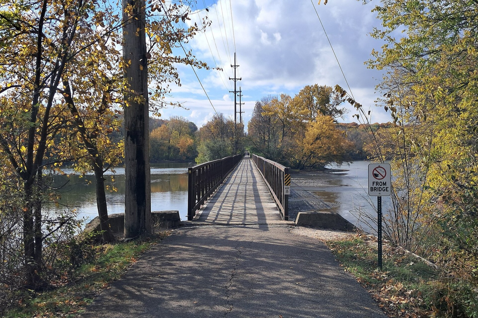
The Fox River Trail is the river ride beyond the city limits. It follows the water through a chain of river towns and forest preserves. It belongs among the Routes & Trails that reward a train ride out of town.
What the trail is
The Forest Preserve District of Kane County calls it the most recognized trail system in the county3. The district puts the length at 43 miles of biking, hiking and cross-country skiing3. Other sources count from just over 38 to 45.7 miles1,2.
The path is rail-trail. It was built on stretches of three former railroads: Chicago, Aurora & Elgin; Aurora, Elgin & Fox River Electric; and Chicago & North Western3. Old rail beds mean long sections with little grade and wide curves, while the purpose-built sections sit closer to the river1.
The route, north to south
The trail connects Algonquin, Carpentersville, Dundee, Elgin, South Elgin, St. Charles, Geneva, Batavia, North Aurora, Aurora, Montgomery and Oswego1.
| Section | What to know |
|---|---|
| Algonquin to Elgin | Starts at the McHenry County line1 |
| South of Elgin | About 3.5 miles on, the trail crosses the river on a bridge built along the original 1896 piers2 |
| South Elgin | An electric trolley runs at the Fox River Trolley Museum2 |
| St. Charles to Geneva | South of St. Charles the route runs beside Route 25 on the east bank or Route 31 on the west1 |
| Batavia to North Aurora | The trail splits and runs along both sides of the river1 |
| Aurora | Both sides of the river for about a mile, between East Illinois Street and East New York Street2 |
| Oswego | Southern end at Washington Street and South Harrison Street2 |
The river crossings matter. The trail uses at least six bridges, some built only for bikes and pedestrians3. The path runs on both banks in places, so a wrong turn is easy3. Signage is good in most parts. Carry a map on a longer ride3.
Surface and hazards
The district calls the path paved, and warns it can be challenging at times3. TrailLink lists asphalt, concrete and crushed stone2. The dedicated-use sections are asphalt1. A few portions cross intersections or run on public streets, so this is not a continuous car-free path1. Slow down at every crossing.
A 1-mile gap in Aurora closed in 2016 with a protected bike lane1.
Stops worth the detour
Fox River Shores, Carpentersville. A one-mile waterfront that opened in 19884. The Fox River Bike Trail runs the length of the property4. The trail here began in 1988, after the Chicago & North Western spur was abandoned4.
Fabyan Forest Preserve, Geneva. Thousands of people jog and bike its trails and cross the river on its bridge6. The preserve holds the Fabyan Villa Museum, the Japanese Tea Garden and the Fabyan Windmill6. The windmill is Dutch in style, dates to the 1850s, and was moved to the river and refurbished in 19141.
Les Arends Forest Preserve, Batavia. It protects over 3,600 feet of Fox River shoreline, and the paved regional trail runs its full length5. It has parking, picnic shelters and restrooms5.
Batavia Depot Museum. The west-side trail follows the former Chicago & North Western right of way past it1.
Montgomery Dam. Four miles from the southern end, a popular fishing spot and one of 13 dams on the river2.
Hudson Crossing Park, Oswego. Along the river, it has playgrounds, picnic areas, benches, restrooms and drinking fountains2.
Forest preserve land opens daily from sunrise to sunset6.
Connecting trails
The trail meets the Illinois Prairie Path in four places: Elgin, Geneva, Batavia and Aurora1. The Prairie Path’s own count agrees that it intersects the Fox River Trail four times7. See the Illinois Prairie Path guide to extend a ride east toward Wheaton. In St. Charles the Great Western Trail joins1, and in Algonquin the Prairie Trail does1.
The Algonquin-to-Elgin stretch is part of the Grand Illinois Trail1. For a longer day, pair this ride with the I&M Canal State Trail.
Getting there from Chicago
Oswego is 50 miles west of Chicago2. Metra allows bikes on all trains, either in the priority seating areas of ADA railcars or in marked bike spaces8. Space goes first come, first served8. Read the Metra bike rules before you board. For the wider list of rides, start from best bike rides in Chicago.
Read next
Illinois Prairie Path: Length, Surface, Branches, Parking and Rules
The Illinois Prairie Path is 61 miles of crushed-limestone trail west of Chicago: its branches, the Forest Park CTA station start, parking and trail rules.
routesI&M Canal State Trail: Rockdale to LaSalle by Bike
The Illinois & Michigan Canal State Trail runs 61.5 miles along the old towpath from Rockdale to LaSalle. Sections, surface, stops and tires.
routesBest Bike Rides in Chicago: Trails Ranked by Type of Ride
The best bike rides in Chicago: the Lakefront Trail, The 606, North Branch Trail, North Shore Channel and the forest preserves, with lengths and surfaces.
Questions people ask
Where does the Fox River Trail start and end?
The northern end is in Algonquin, at the McHenry County line, and the southern end is in Oswego in Kendall County1. TrailLink lists the end points at Souwanas Trail in Algonquin and Washington Street and South Harrison Street in Oswego2.
How long is the Fox River Trail?
The Forest Preserve District of Kane County puts it at 43 miles3.
Is the Fox River Trail paved?
Yes. The district calls it a paved path3. The surfaces are asphalt, concrete and crushed stone2. A few stretches cross intersections or run on public streets1.
Sources
- Fox River Trail (Illinois)REFERENCE
Wikipedia · en.wikipedia.org · checked 2026-10-19 - Fox River Trail (IL)NONPROFIT
Rails-to-Trails Conservancy TrailLink · traillink.com · checked 2026-10-19 - Forest Preserve District Set to Buy Parcels for Fox River Trail in South ElginPRESS
Kane County Connects (Kane County) · retired.kanecountyconnects.com · checked 2026-10-19 - Fox River Shores Forest PreserveGOV
Forest Preserve District of Kane County · kaneforest.com · checked 2026-10-19 - Les Arends Forest PreserveGOV
Forest Preserve District of Kane County · kaneforest.com · checked 2026-10-19 - Fabyan Forest PreserveGOV
Forest Preserve District of Kane County · kaneforest.com · checked 2026-10-19 - Illinois Prairie PathREFERENCE
Wikipedia · en.wikipedia.org · checked 2026-10-19 - What to Expect OnboardGOV
Metra · metra.com · checked 2026-10-19
Photo credits (1)
- AlphaBeta135 / Wikimedia Commons · CC BY 4.0 · source

Laws are quoted from Illinois statute and the Chicago Municipal Code; prices from each operator on the date shown. Editorial policy · Corrections.