Illinois Prairie Path: Length, Surface, Branches, Parking and Rules
The Illinois Prairie Path is 61 miles of crushed-limestone trail west of Chicago: its branches, the Forest Park CTA station start, parking and trail rules.
The Illinois Prairie Path is about 61 miles of trail in Cook, DuPage and Kane Counties1. Three branches start near Wheaton: the Main Stem runs 15 miles east to the Forest Park CTA station, the Elgin Branch about 16 miles and the Aurora Branch about 142. The surface is primarily crushed limestone1.
- At a glance
- Length
- About 61 miles1
- Surface
- Primarily crushed limestone1
- From Chicago
- Main Stem ends at the Forest Park CTA station, 15 miles from Wheaton2
- Speed limit
- 15 mph for all users4
On this page
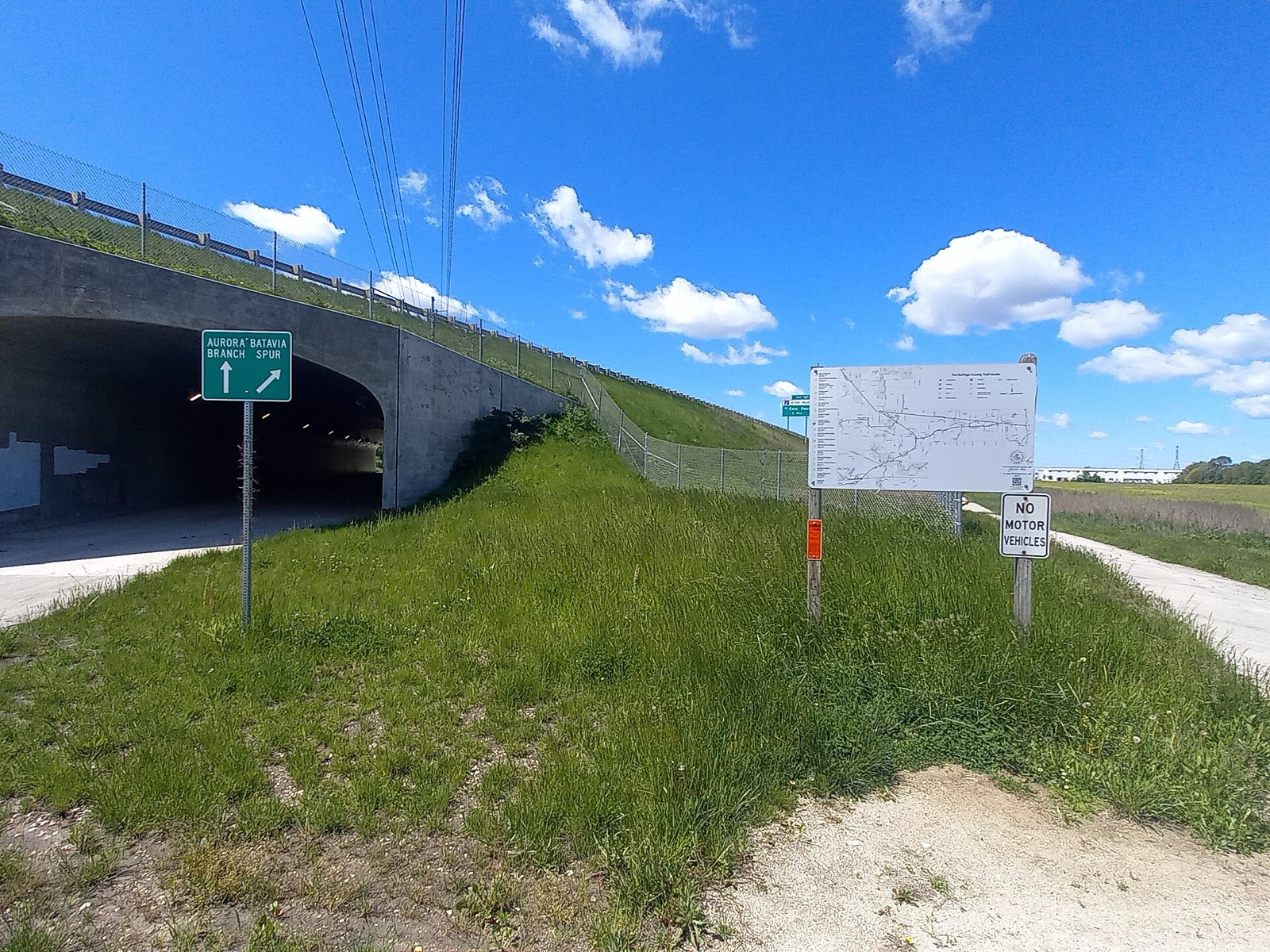
The Prairie Path is a former rail corridor that now carries riders through the western suburbs to the Fox River. Its Main Stem starts at a CTA station. More rides are in Routes & Trails.
What it is
The Illinois Prairie Path is a multi-use nature trail for non-motorized traffic, spanning about 61 miles across Cook, DuPage and Kane Counties1. It follows the right-of-way of the former Chicago, Aurora & Elgin electric railroad, which carried commuters and freight between Chicago and the western suburbs1. It was the first rail-to-trail conversion in the United States1. The surface is primarily crushed limestone1.
The route includes many recreated prairie restorations1. The Path’s emblem shows railroad spikes arranged in an inverted Y1; the Y forms a rough map of the route1.
The three branches
All three branches start at one point just west of downtown Wheaton2. Concrete mile markers name the branch and count the miles from Wheaton2.
| Branch | Length | Ends at |
|---|---|---|
| Main Stem | 15 miles | Forest Park CTA station2 |
| Elgin Branch | About 16 miles | Elgin, at the Fox River Trail2 |
| Aurora Branch | About 14 miles | RiverEdge Park, Aurora2 |
| Geneva Spur | 6 miles | Geneva2 |
| Batavia Spur | 5 miles | Batavia2 |
The Elgin Branch is the longest of the three2. The path meets Kane County’s Fox River Trail four times2. See the Fox River Trail guide for that side. The trail map names stops along the Main Stem such as the Maywood Trailhead, Berkeley Town Park and the Villa Park Historical Society Museum6. Along the Elgin Branch it lists Lincoln Marsh Wetlands and Kline Creek Farm6.
Riding it from Chicago
The Main Stem ends at the Forest Park CTA station, so the CTA is the way in from the city2. A pedestrian bridge over the Des Plaines River between Maywood and Forest Park opened in late October 2006, after lighting and emergency call boxes were installed2. For the rules on carrying a bike, read bikes on CTA trains and bikes on Metra.
Wheaton, the hub of all three branches, is 15 miles from Forest Park by the Main Stem2. The Main Stem and the Elgin Branch form part of the 575-mile Grand Illinois Trail2.
Amenities and parking
The path has comfort stations, drinking fountains or water pumps, and benches5. Many downtowns along it have an ice cream store close by5.
Every village and city along the Main Stem has public parking near the path5. Most of it is metered or leased for commuters, though some is free5. In Cook County the path runs through residential areas, where free parking is available on adjacent or cross streets5. Named options include a lot east of York Road in Elmhurst and Elmer J. Hoffman Park in Wheaton5.
In March 2025 the DuPage County Department of Transportation posted “Not a Parking Lot” signs at gravel lots on County Farm and Geneva Roads5. Look for another lot.
Trail rules
The Path posts a speed limit of 15 mph for all users4. Keep right, and call out “passing on the left” when you overtake4. Cyclists should wear helmets at all times and obey posted signs at crossings4. Pets must be leashed4. Camping is not allowed4.
Class 1, 2 and 3 e-bikes are allowed on DuPage County trails4. Other motorized vehicles are not allowed4.
How it came about
On September 30, 1963, the Chicago Tribune published a letter from May Theilgaard Watts urging a public path on the abandoned route of the railroad3. The response was immediate and enthusiastic3. The CA&E had ended commuter service in 1957 and freight in 1959, and the right-of-way was abandoned in 19611.
Fourteen founders took 953 days to secure a 12-year lease from DuPage County for 27 miles3. In June 1971 the path became the first National Recreation Trail in Illinois3. Volunteers built a bridge in Wheaton in 1982 and 1983 for $25,000, against bids above $250,0003. DuPage County took over maintenance in 19863. The path was inducted into the Rails-to-Trails hall of fame in August 20082.
Who looks after it
Segments are maintained by DuPage County, the Kane County Forest Preserve District, several park districts and villages3. The Illinois Prairie Path not-for-profit’s all-volunteer board funds projects and trail amenities1. Pair this ride with the best bike rides in Chicago if you want the lakefront on another day.
Read next
Fox River Trail: Route, Towns, Surface and How to Ride It
The Fox River Trail runs about 43 paved miles through Kane County from Algonquin to Oswego. Towns, bridges, connections and where to start.
routesSalt Creek Trail: Route, Length, Access Points and Closures
The Salt Creek Trail follows the creek for 25 miles from Busse Woods to Brookfield Zoo. Where to join, trail rules, flood underpasses and closures.
routesBest Bike Rides in Chicago: Trails Ranked by Type of Ride
The best bike rides in Chicago: the Lakefront Trail, The 606, North Branch Trail, North Shore Channel and the forest preserves, with lengths and surfaces.
Questions people ask
How long is the Illinois Prairie Path?
The trail spans approximately 61 miles1. The Main Stem is 15 miles, the Elgin Branch about 16 and the Aurora Branch about 14, with spurs of 6 miles to Geneva and 5 miles to Batavia2.
Is the Illinois Prairie Path paved?
No. The path is surfaced primarily with crushed limestone, which sheds water quickly after rain1.
Where do you park for the Illinois Prairie Path?
Every village along the Main Stem has public parking near the path, mostly metered or leased commuter spaces5. On weekends most leased spaces are open to path users, and metered spaces can almost always be used on Sundays without paying5.
Sources
- About the TrailNONPROFIT
Illinois Prairie Path · ipp.org · checked 2026-10-19 - Illinois Prairie PathREFERENCE
Wikipedia · en.wikipedia.org · checked 2026-10-19 - Trail HistoryNONPROFIT
Illinois Prairie Path · ipp.org · checked 2026-10-19 - Trail EtiquetteNONPROFIT
Illinois Prairie Path · ipp.org · checked 2026-10-19 - Trail AmenitiesNONPROFIT
Illinois Prairie Path · ipp.org · checked 2026-10-19 - Illinois Prairie Path Trail MapNONPROFIT
Illinois Prairie Path · ipp.org · checked 2026-10-19
Photo credits (1)
- AlphaBeta135 / Wikimedia Commons · CC BY 4.0 · source

Laws are quoted from Illinois statute and the Chicago Municipal Code; prices from each operator on the date shown. Editorial policy · Corrections.